[Tile-serving] [openstreetmap/osm2pgsql] WORK IN PROGRESS: Add pole_of_inaccessibility() function in Lua for polygons (PR #1822)
Jakob Miksch
notifications at github.com
Fri Nov 18 18:14:49 UTC 2022
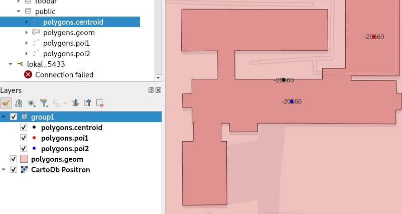
The computation worked well for my test area (Heidelberg city).
I like the approach with the ellipse a lot. In many cases it gives better results for labeling than the circle. Like in these examples:
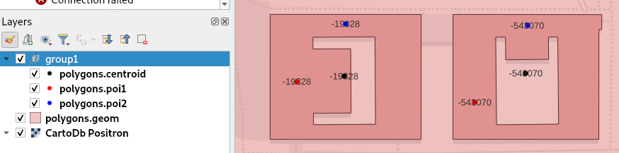
However, in the following example I was surprised about the location of `poi2`. I would have expected it somewhere in the right-top of `poi1` (blue)
--
Reply to this email directly or view it on GitHub:
https://github.com/openstreetmap/osm2pgsql/pull/1822#issuecomment-1320371009
You are receiving this because you are subscribed to this thread.
Message ID: <openstreetmap/osm2pgsql/pull/1822/c1320371009 at github.com>
-------------- next part --------------
An HTML attachment was scrubbed...
URL: <http://lists.openstreetmap.org/pipermail/tile-serving/attachments/20221118/df24127f/attachment.htm>
More information about the Tile-serving
mailing list